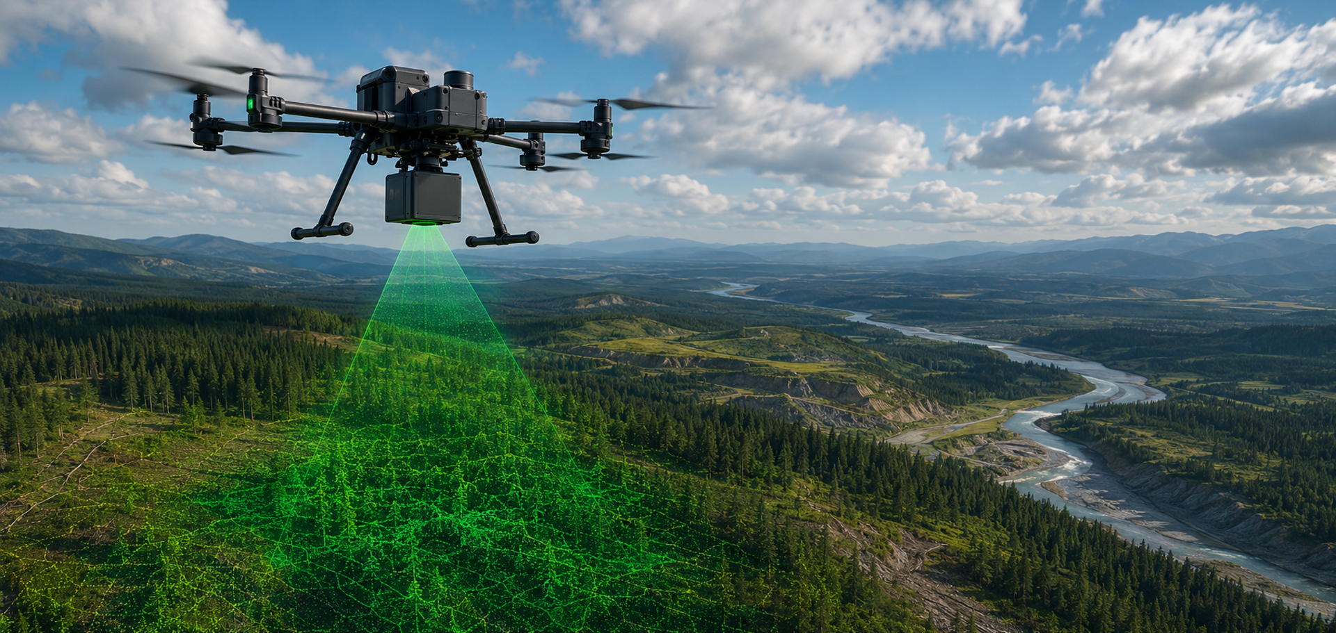

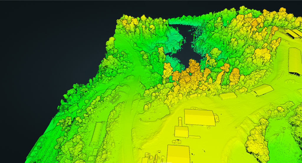
LiDAR (Light Detection and Ranging) is an advanced remote sensing technology that uses millions of laser pulses emitted from a UAV-mounted laser scanner to accurately measure the position of the ground and surrounding features. The resulting three-dimensional point cloud provides highly accurate elevation information, making LiDAR the preferred solution for engineering, mining, environmental, and infrastructure projects.
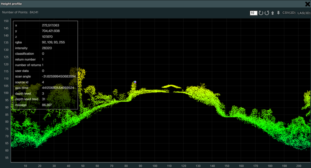
Unlike photogrammetry, which derives surface information from overlapping aerial photographs, LiDAR directly measures distances using laser pulses. This enables the creation of highly accurate terrain models and, in many environments, allows the ground surface to be mapped beneath vegetation, providing a true representation of the terrain.
LiDAR is ideally suited to applications requiring precise elevation data, including topographic mapping, mine planning, infrastructure design, drainage analysis, corridor mapping, stockpile volume calculations, forestry, and environmental monitoring. The technology delivers consistent, repeatable results while significantly reducing survey time compared to conventional ground survey methods.
By establishing an accurate three-dimensional baseline, future surveys can be directly compared to monitor terrain changes, quantify earthworks, assess rehabilitation progress, and support informed engineering and operational decisions.
Typical Deliverables

Ortho-Photogrammetry
Lidar
Technology
High-resolution aerial imagery processed using photogrammetric software
Laser pulses measure millions of individual 3D points
Primary Output
Orthophoto, DSM and textured 3D models
Dense point cloud, DTM, DSM and bare-earth models
Terrain Mapping
Accurately maps visible ground surfaces
Directly measures terrain and elevations with high precision
Vegetation
Limited by dense vegetation and canopy cover
Laser pulses can penetrate vegetation gaps to model the ground beneath
Surface Detail
Excellent visual detail and true-colour imagery
Exceptional three-dimensional measurement and elevation detail
Terrain Representation
High horizontal accuracy with excellent visual representation
High horizontal and vertical accuracy for engineering and surveying applications
Best Applications
Site mapping, orthophotos, progress monitoring, environmental surveys, volume calculations, inspection and documentation
Engineering surveys, topographic mapping, mine planning, corridor mapping, forestry, drainage analysis and precise terrain modelling
Deliverables
Orthophotos, DSM, contours, textured 3D models, volume calculations
Point clouds (LAS/LAZ), DTM, DSM, contours, cross-sections, volumes and engineering surfaces
All aerial services and compliance depicted or advertised are provided by DC Geomatics Drone Services, a registered ROC holder, as part of a formal Aerial Services Agreement.
| Cookie | Duration | Description |
|---|---|---|
| cookielawinfo-checkbox-analytics | 11 months | This cookie is set by GDPR Cookie Consent plugin. The cookie is used to store the user consent for the cookies in the category "Analytics". |
| cookielawinfo-checkbox-functional | 11 months | The cookie is set by GDPR cookie consent to record the user consent for the cookies in the category "Functional". |
| cookielawinfo-checkbox-necessary | 11 months | This cookie is set by GDPR Cookie Consent plugin. The cookies is used to store the user consent for the cookies in the category "Necessary". |
| cookielawinfo-checkbox-others | 11 months | This cookie is set by GDPR Cookie Consent plugin. The cookie is used to store the user consent for the cookies in the category "Other. |
| cookielawinfo-checkbox-performance | 11 months | This cookie is set by GDPR Cookie Consent plugin. The cookie is used to store the user consent for the cookies in the category "Performance". |
| viewed_cookie_policy | 11 months | The cookie is set by the GDPR Cookie Consent plugin and is used to store whether or not user has consented to the use of cookies. It does not store any personal data. |