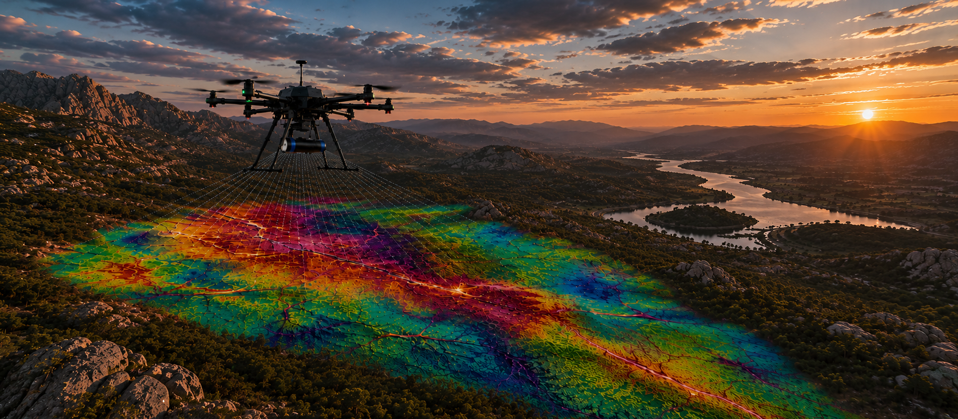
UAV-based radiometric surveys offer a high-resolution, efficient, and low-impact method for mapping natural gamma radiation (potassium, uranium, and thorium) across varied terrain. Using lightweight, UAV-optimized gamma spectrometers flown at low altitudes and slow speeds, we collect detailed data with centimetre-accurate positioning via RTK/PPK GNSS. Fully autonomous and terrain-following, our systems safely access remote or rugged areas with minimal environmental disturbance and no need for ground crews in hazardous zones. Radiometric data is calibrated to international standards and can be fully integrated with magnetic or multisensor survey platforms, providing a powerful toolset for mineral exploration, geological mapping, and environmental assessment.
Features:
Fixed-Wing
UAV
Traditional method for collecting data for mineral and resource exploration
Lightweight and compact platform with newly developed sensors that produce data of a far superior quality to fixed-wing
Flying Height
General standard is 80m above ground
UAV surveys can be flown at 25m
Speed
Approximately 220 km/hr
Approximately 30 km/hr
Terrain-following
Controlled with DGPS but limitations exist due to the climb rate of aircraft making difficult terrain survey inaccurate and very unsafe
Accurate terrain-following due to software control and vertical climbing ability allowing UAV’s to survey mountainous areas and valleys accurately
Distance from Base
Permanent base required with landing space, fuel etc. flying base to survey area is not regarded as production
Flexible base of operations located next to daily survey area
Cost of Service
Larger crew, fuel and fixed base of operations results in a more costly service
Small crew, no fuel cost and flexible base of operations results in a cost-effective service
Safety
Aircraft may require between 1 – 3 personnel on-board and the low flying height significantly increases the risk of aircraft accidents
The platform is unmanned therefore any accident results in zero loss of life
Data Quality
Higher operating altitudes and survey speeds reduce the gamma-ray signal received from the ground, resulting in lower spatial resolution and reduced ability to identify small-scale radiometric features.
The combination of low flying height, precise terrain-following, and slower survey speeds maximizes ground signal strength and spatial resolution, producing higher-quality radiometric datasets with improved feature definition.
All aerial services and compliance depicted or advertised are provided by DC Geomatics Drone Services, a registered ROC holder, as part of a formal Aerial Services Agreement.
| Cookie | Duration | Description |
|---|---|---|
| cookielawinfo-checkbox-analytics | 11 months | This cookie is set by GDPR Cookie Consent plugin. The cookie is used to store the user consent for the cookies in the category "Analytics". |
| cookielawinfo-checkbox-functional | 11 months | The cookie is set by GDPR cookie consent to record the user consent for the cookies in the category "Functional". |
| cookielawinfo-checkbox-necessary | 11 months | This cookie is set by GDPR Cookie Consent plugin. The cookies is used to store the user consent for the cookies in the category "Necessary". |
| cookielawinfo-checkbox-others | 11 months | This cookie is set by GDPR Cookie Consent plugin. The cookie is used to store the user consent for the cookies in the category "Other. |
| cookielawinfo-checkbox-performance | 11 months | This cookie is set by GDPR Cookie Consent plugin. The cookie is used to store the user consent for the cookies in the category "Performance". |
| viewed_cookie_policy | 11 months | The cookie is set by the GDPR Cookie Consent plugin and is used to store whether or not user has consented to the use of cookies. It does not store any personal data. |