A New Standard in Exploration Technology
Precision UAV and airborne geophysical solutions, specialising in high-resolution magnetics, radiometrics and electromagnetics, together with LiDAR and orthophotography, engineered for accuracy, efficiency and operational confidence in mineral exploration and resource development.

Services

Ultra-high-resolution magnetic mapping with UAVs for detailed near-surface investigations and targeted exploration.

Radiometric 11

UAV RADIOMETRICS

Precise gamma-ray spectrometry using UAVs to map natural radiation signatures for mineral exploration and environmental applications.

TDEM 2

UAV ELECTROMAGNETICS (TDEM)

Next-generation UAV-borne EM systems for subsurface conductivity mapping, ideal for groundwater, mining, and geotechnical projects.

High-resolution orthomosaic generation for detailed mapping, topographic modeling, and surface analysis.

Lidar

UAV LIDAR

UAV LiDAR surveys deliver high-resolution terrain models and highly accurate mapping solutions, enabling detailed analysis for exploration and development.

Radiometric 10

FIXED-WING MAGNETIC
AND RADIOMETRIC SURVEYS

High-efficiency magnetic and radiometric data collection across large-scale survey areas, using specialized fixed-wing aircraft.

Why AeroPhysX?

Precision geophysics is built on more than technology. AeroPhysX combines decades of airborne geophysical experience with advanced UAV platforms, modern high-sampling-rate sensors and proven field expertise to deliver accurate, reliable data across diverse terrain and operating environments worldwide.

experience_icon

International Experience

Extensive UAV and airborne geophysical survey experience across Africa, North America and South America.

tech_icon

Advanced Survey Technology

Modern high-sampling-rate sensors  with advanced UAV platforms and autonomous terrain-following capabilities.

sensor_icon

Multi-Sensor Capability

Magnetics, radiometrics, electromagnetics, LiDAR and orthophotography from a single specialist provider.

precision_icon

Operational Confidence

Proven acquisition methodologies and rigorous quality control for demanding exploration environments.

About Us

EXPERIENCE

With over 22 years in airborne geophysics services  and a collective exceeding 200 years of industry expertise, AeroPhysX delivers world-class survey solutions.

We specialize in technologies that drive new value for exploration, environmental studies, and mineral resource development.

Our team brings deep, proven experience across Africa and other emerging markets, working with leading mining firms, government agencies, private prospectors, and landowners.

HISTORY

AeroPhysX was founded to transform exploration using cutting-edge technology in Africa and beyond.

Our global operations focus on offering UAV, fixed-wing and helicopter magnetic, radiometric and EM surveys, from data acquisition through to final mapping.

We have owned and operated a range of aircraft platforms including fixed-wing and  helicopters, with approved installations across all major types, as well as standard and heavy-lift UAV’s.

VISION

Our vision is to deliver high-performance, cost-effective airborne surveys while advancing the frontiers of geophysical technology.

We were early pioneers in drone-based magnetic surveying and the first in Africa to implement the Magarrow system.

Today, we lead in UAV survey innovation and are actively developing advanced software tools for terrain following, navigation, and data processing.

MISSION

We strive to be the world’s most trusted provider of accurate, efficient, and client-focused airborne survey solutions.

By continuously integrating new technologies and refining methodologies, especially in drone-based workflows, we aim to set a new standard in data acquisition.

Our team has collaborated for over seven years on developing high-end processing techniques and scalable systems that empower smarter, faster exploration.

Global Footprint

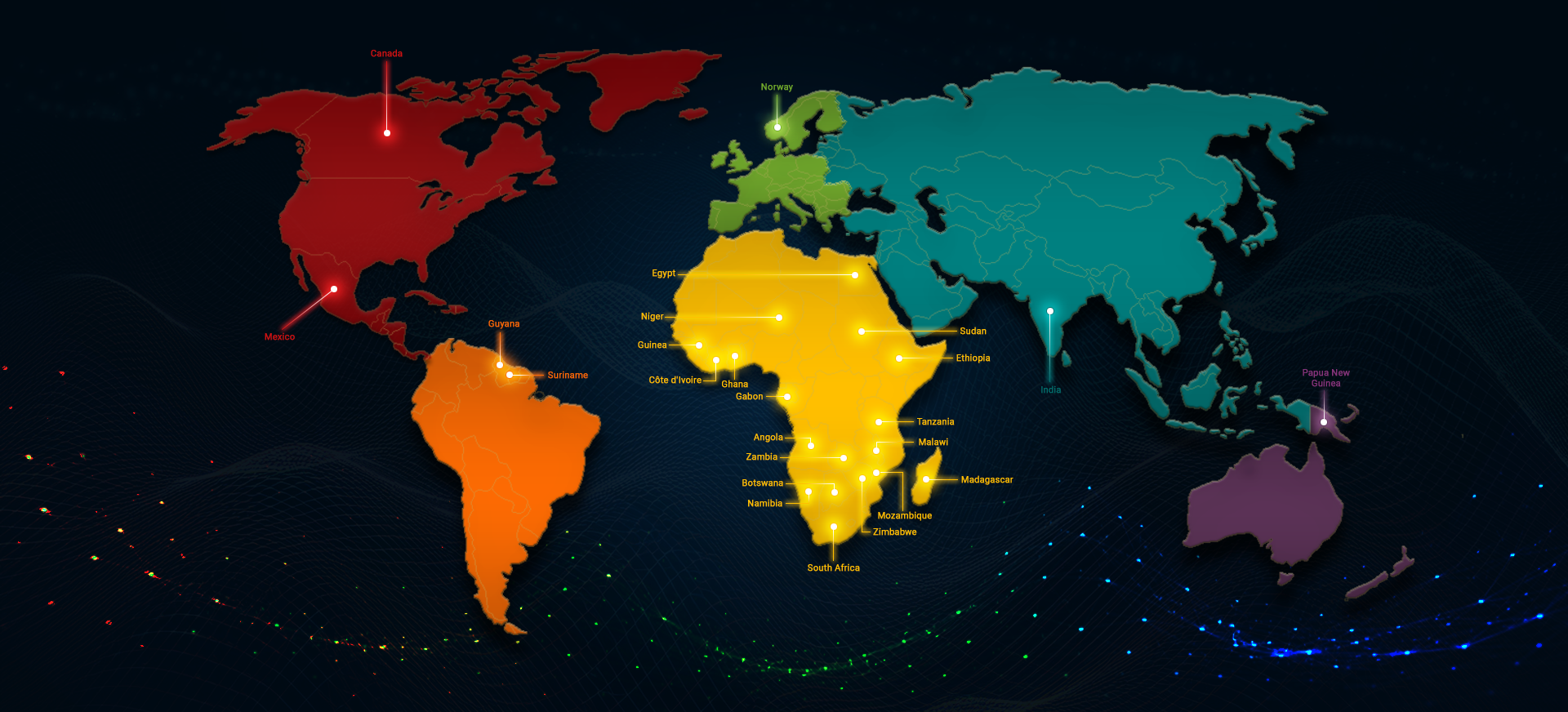
At AeroPhysX, exploration is in our DNA. Our global footprint stretches from the deserts of Namibia to the rainforests of Papua New Guinea, across the gold belts of West Africa and into the resource-rich landscapes of the Americas. Every project is a journey into new terrains, new partnerships, and new possibilities —our global reach mirrors our drive for innovation. We have delivered cutting-edge geophysical data acquisition in over twenty countries — each site pushing us to refine, adapt, and advance. Our expanding footprint is a testament to our commitment to precision technology, client satisfaction, and adherence to both international and local standards.

News and Resources

Read about current research articles, presentations and our latest news.

Our Clients

We have worked closely and successfully with a wide range of clients from government departments and major companies to private individuals. We pride ourselves on meeting and exceeding our client’s expectations.