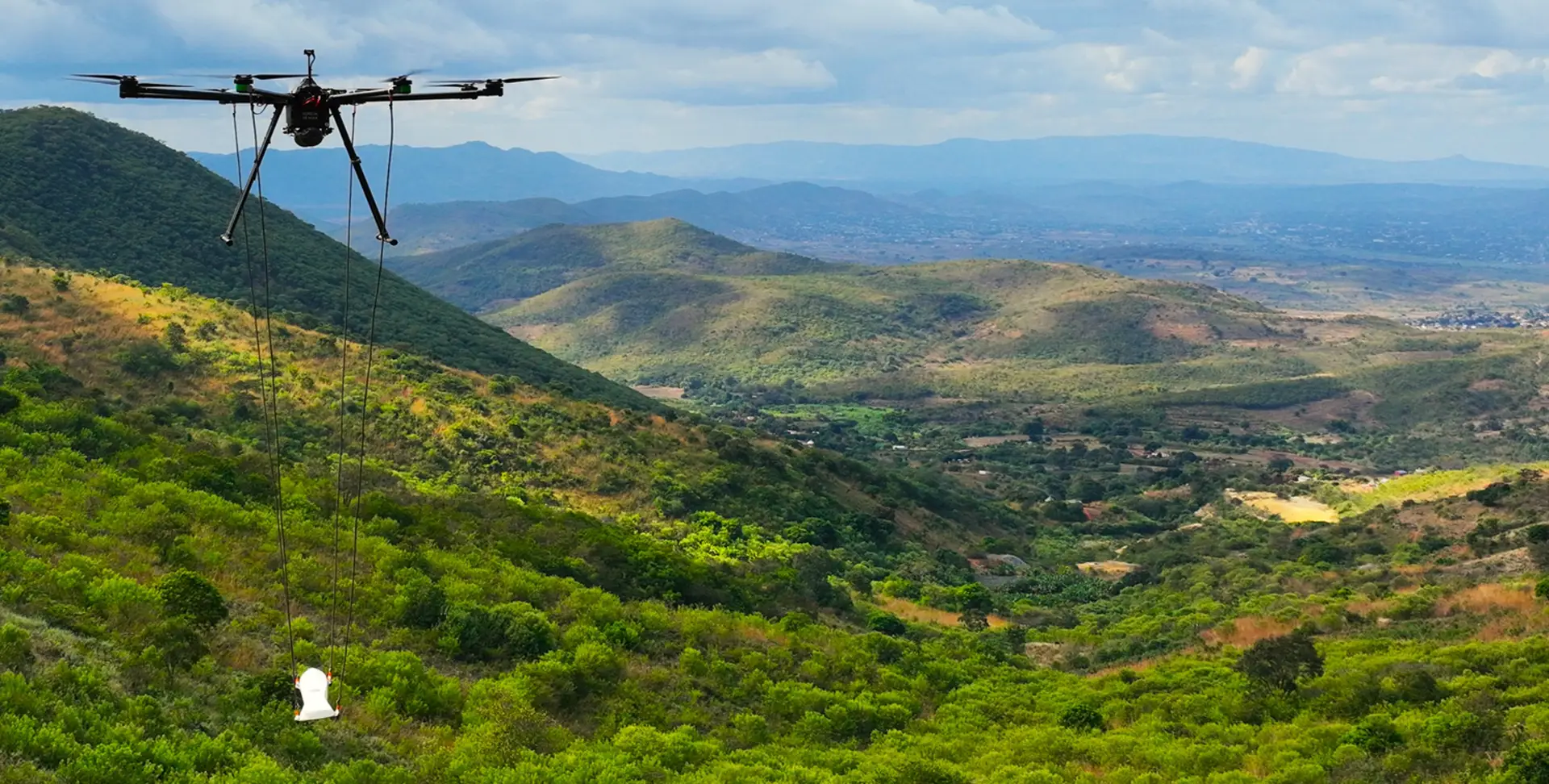
UAV magnetic surveys offer a comprehensive and highly efficient solution for a wide range of geophysical and exploration applications. They are particularly well-suited for high-resolution magnetic mapping, water detection, borehole and well identification, as well as mineral, oil and gas, and geothermal exploration. With magnetic sampling at 1,000 times per second and centimetre-level data resolution, these systems deliver exceptionally detailed subsurface insights. Fully autonomous flight capabilities, terrain-following technology, and precision flying enable reliable operation in challenging and remote terrain. UAVs can also operate at slow acquisition speeds and during night-time conditions, allowing for flexible deployment schedules and extended survey windows. Total system integration and robust redundancy features ensure both data integrity and operational safety, contributing to a Green (low) risk rating in safety and risk assessments.
Notably, AeroPhysX is one of the few companies with the expertise to correctly and accurately compensate magnetic data acquired by UAVs, ensuring high-quality, interpretable results that meet professional geophysical standards. This combination of precision, adaptability, and data accuracy makes UAV magnetic surveys a powerful tool for modern exploration and resource mapping.
Features:

Fixed-Wing
UAV
Traditional method for collecting data for mineral and resource exploration
Lightweight and compact platform with newly developed sensors that produce data of a far superior quality to fixed-wing
Flying Height
General standard is 80m above ground
UAV surveys can be flown at 25m
Speed
Approximately 220 km/hr
Approximately 30 km/hr
Terrain-following
Controlled with DGPS but limitations exist due to the climb rate of aircraft making difficult terrain survey inaccurate and very unsafe
Accurate terrain-following due to software control and vertical climbing ability allowing UAV’s to survey mountainous areas and valleys accurately
Distance from Base
Permanent base required with landing space, fuel etc. flying base to survey area is not regarded as production
Flexible base of operations located next to daily survey area
Cost of Service
Larger crew, fuel and fixed base of operations results in a more costly service
Small crew, no fuel cost and flexible base of operations results in a cost-effective service
Safety
Aircraft may require between 1 – 3 personnel on-board and the low flying height significantly increases the risk of aircraft accidents
The platform is unmanned therefore any accident results in zero loss of life
Data Quality
Magnetometer standard sampling rate of 10 Hz, considering speed and flying height, results in 1.1 samples every 8 m
Magnetometer sampling rate of a minimum of 250 Hz, considering speed and flying height, results in 250 samples every 8 m
All aerial services and compliance depicted or advertised are provided by DC Geomatics Drone Services, a registered ROC holder, as part of a formal Aerial Services Agreement.
| Cookie | Duration | Description |
|---|---|---|
| cookielawinfo-checkbox-analytics | 11 months | This cookie is set by GDPR Cookie Consent plugin. The cookie is used to store the user consent for the cookies in the category "Analytics". |
| cookielawinfo-checkbox-functional | 11 months | The cookie is set by GDPR cookie consent to record the user consent for the cookies in the category "Functional". |
| cookielawinfo-checkbox-necessary | 11 months | This cookie is set by GDPR Cookie Consent plugin. The cookies is used to store the user consent for the cookies in the category "Necessary". |
| cookielawinfo-checkbox-others | 11 months | This cookie is set by GDPR Cookie Consent plugin. The cookie is used to store the user consent for the cookies in the category "Other. |
| cookielawinfo-checkbox-performance | 11 months | This cookie is set by GDPR Cookie Consent plugin. The cookie is used to store the user consent for the cookies in the category "Performance". |
| viewed_cookie_policy | 11 months | The cookie is set by the GDPR Cookie Consent plugin and is used to store whether or not user has consented to the use of cookies. It does not store any personal data. |